Monitoring Hochvogel

Monitoring Hochvogel
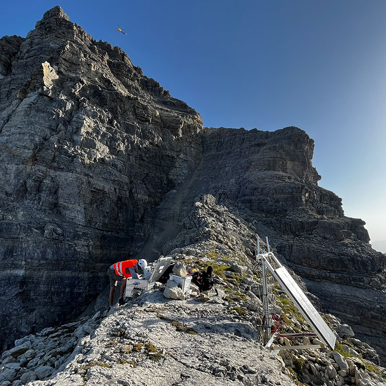
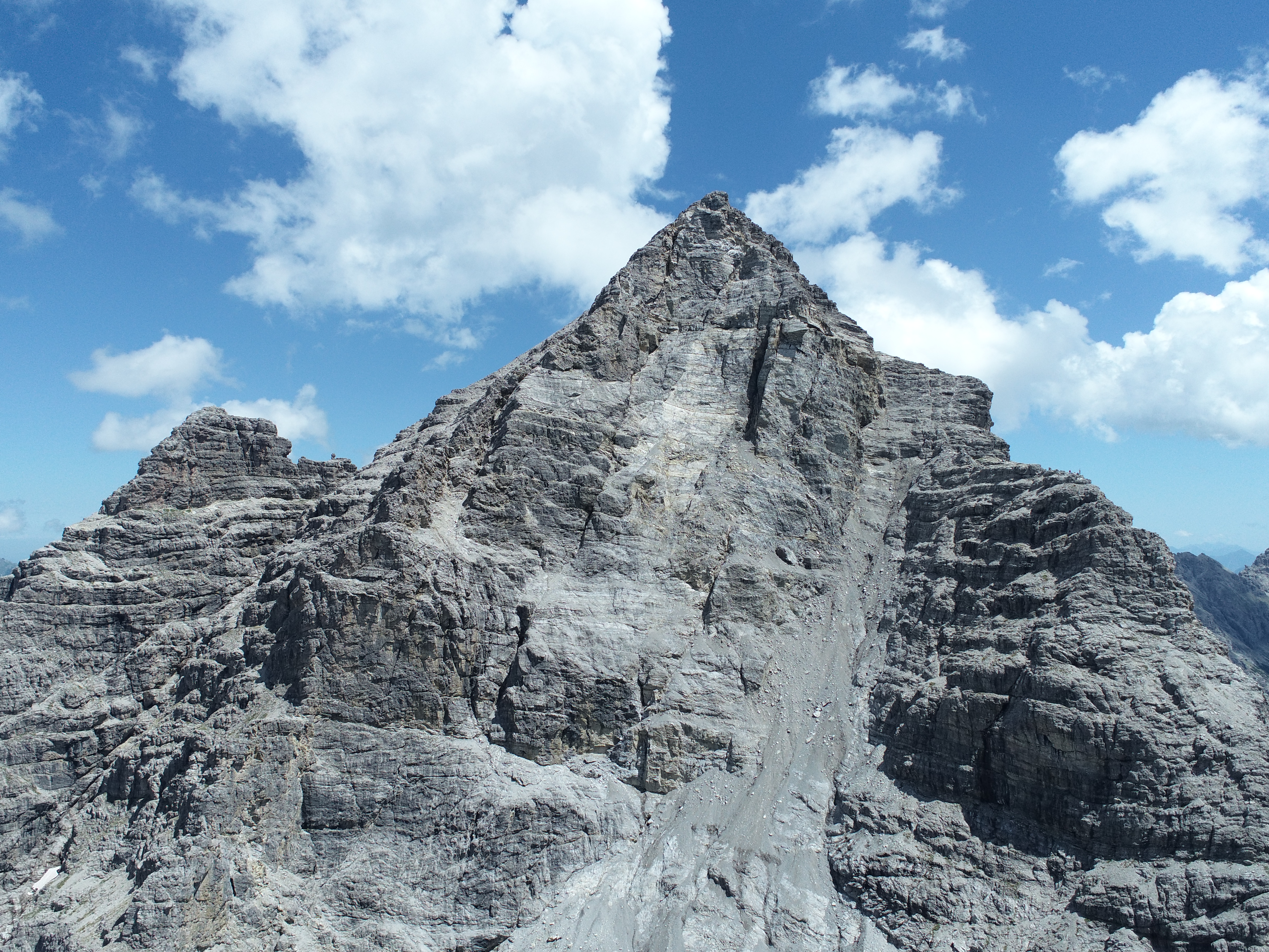
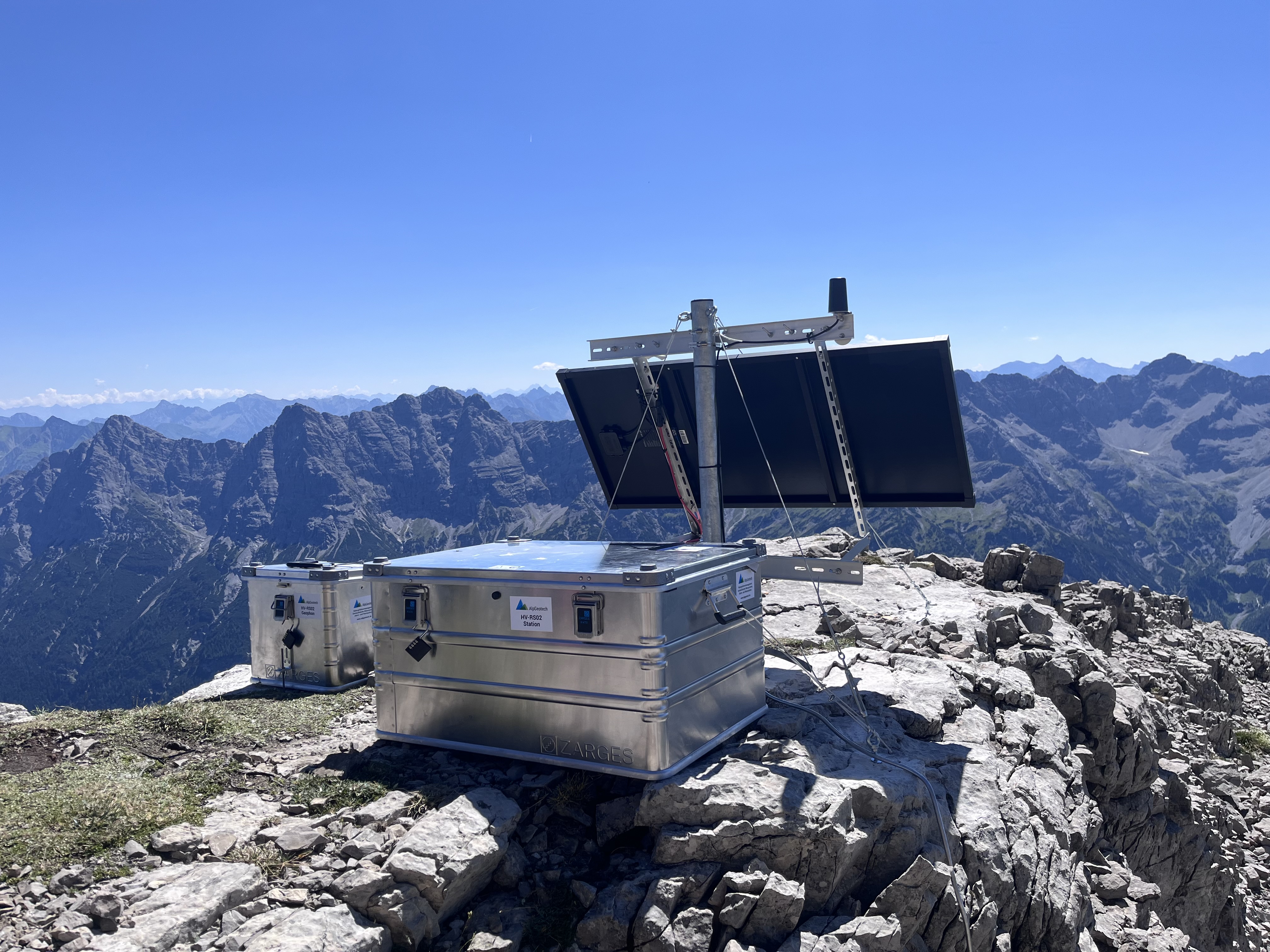
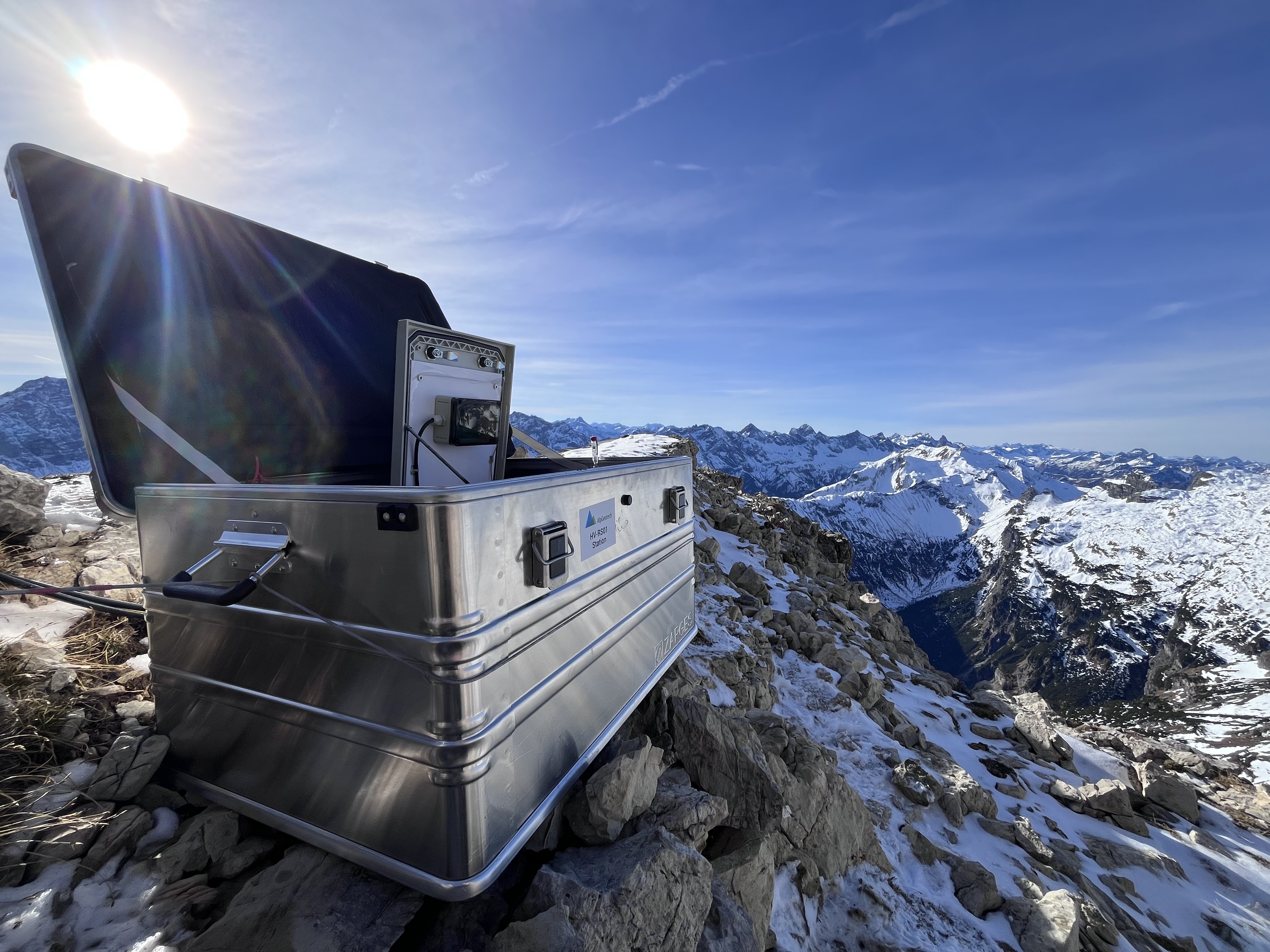
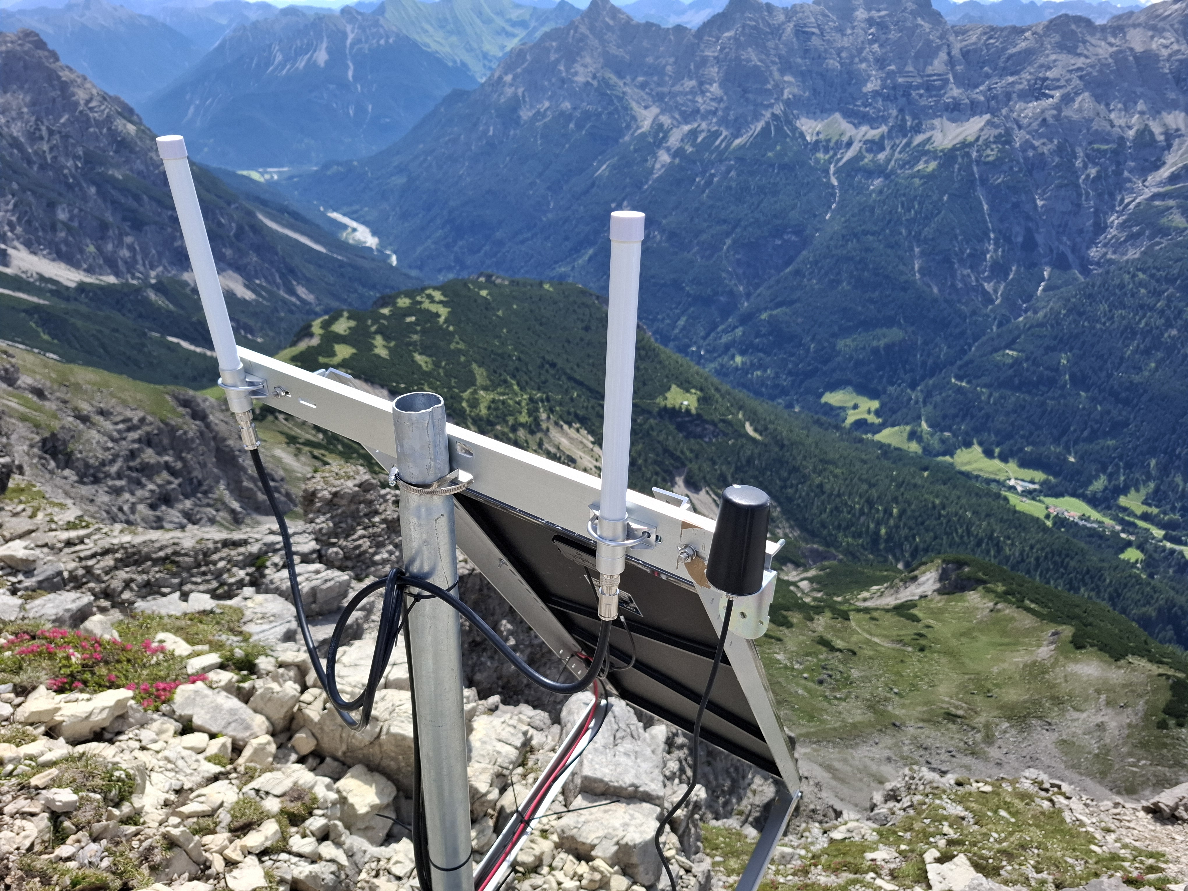
AlpGeotech operates a Rockfall and Deformation Monitoring System at the Hochvogel in collaboration with the Chair of Landslide Research at the Technical University of Munich. The summit sits at 2,592 m on the German-Austrian border and is splitting apart along a fracture system several meters wide. The vertical southwest wall below it produces rockfalls continuously which are recorded by seismic stations. Inform@Risk nodes at the summit measure deformation and the opening rate of a summit crack. All stations run on solar power and send their data by LoRaWAN to the AlpGeotech central server. The site is an operational monitoring installation and a test bed for AlpGeotech hardware under extreme alpine conditions.
Problem Statement

The Hochvogel is a solitary, pyramidal peak of Upper Triassic Hauptdolomit in the Northern Calcareous Alps. The summit block is heavily fractured, and a marl horizon near its base forms a potential gliding plane. The main summit fracture was first documented in 1869 (Barth, 1874). It has since widened to between two and six meters today and reaches at least sixty meters into the massif. The unstable volume is estimated at up to 260,000 m3 (Leinauer et al., 2020). It rises to 400,000 to 600,000 m3 if failure propagates below the marl horizon. The mass is in a creep phase and moves at about 2 mm per month on average (Leinauer et al., 2024).

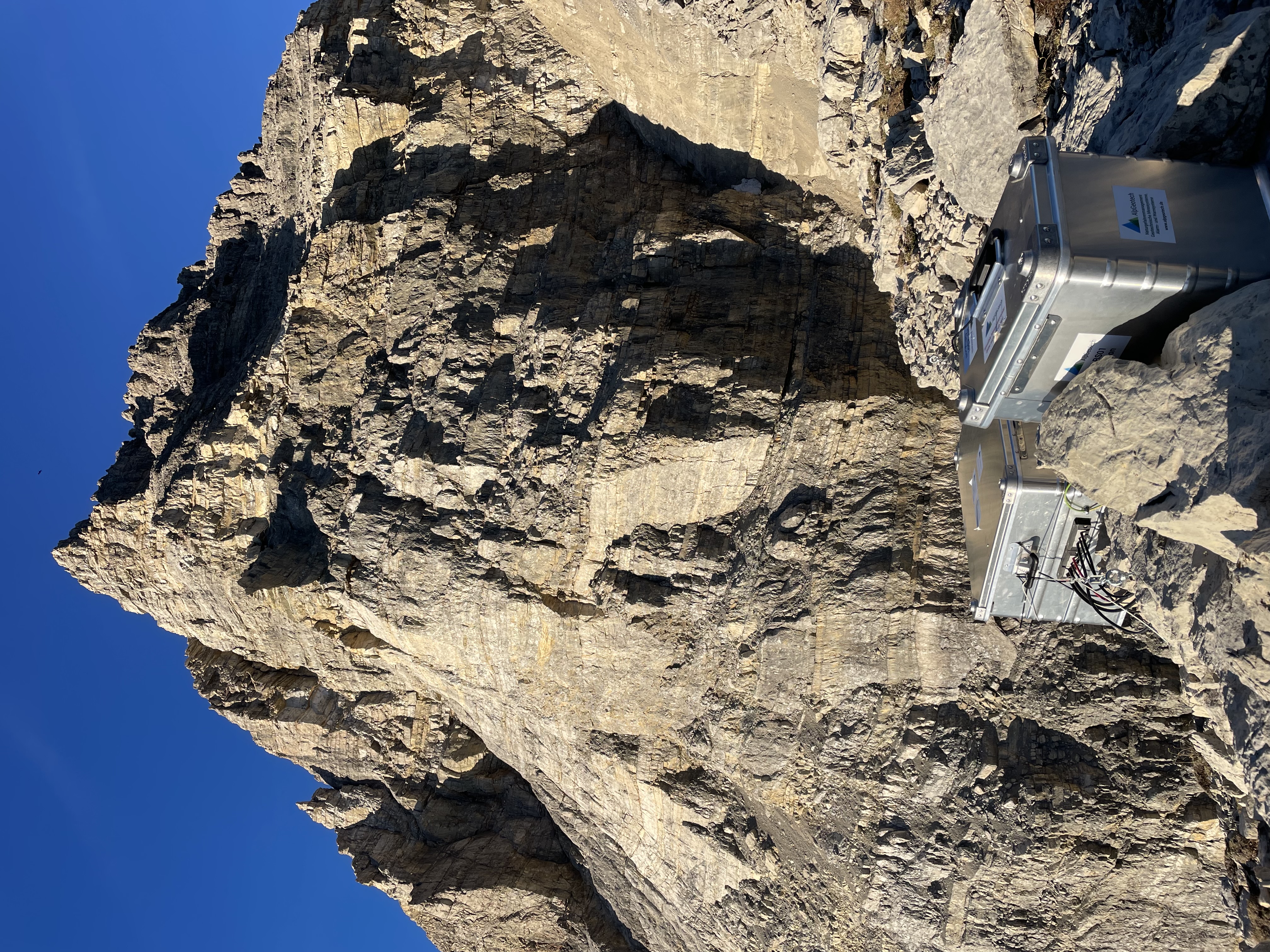
Rockfall from the southwest wall is persistent. More than 600 events larger than 1 m3 were identified between 2010 and 2020, including a multi-stage cliff fall in 2016 that released over 130,000 m3 (Barbosa et al., 2024). The southern via ferrata has been closed since 2014 (Deutscher Alpenverein, 2017). The Weittal valley below the wall is the runout zone for future events.

Rockfall activity is the most direct indicator of how such an instability develops. Laser scanning and photogrammetry measure the volumes, but they give no timing and only work when someone can survey the site. A permanent installation faces hard conditions. The summit can only be reached by a long ascent or by helicopter, and there is no road access and no grid power. Winter temperatures drop well below minus twenty degrees. The exposed peak is hit by lightning repeatedly during the summer months, and direct strikes have destroyed earlier instrumentation here regularly.

Solution

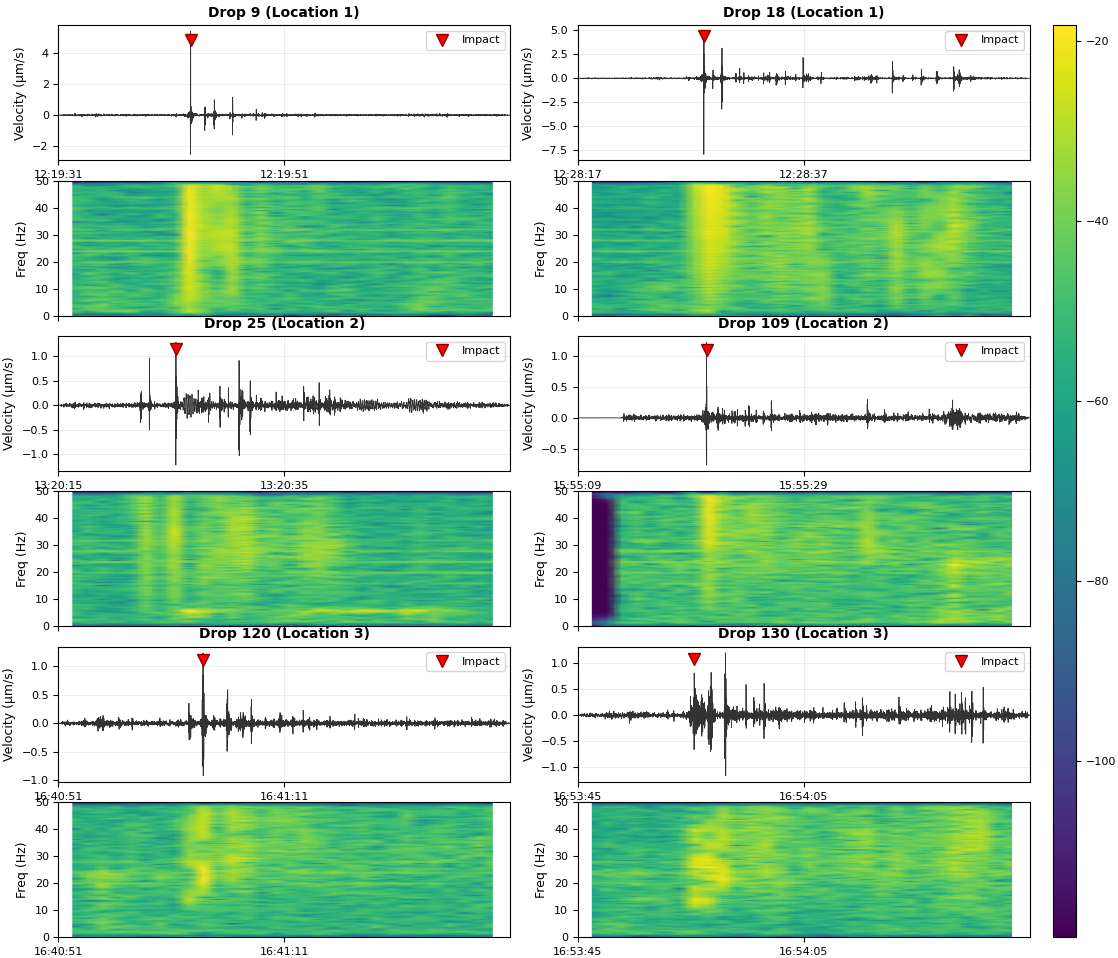
Monitoring began in 2025 with a geophone-based seismic station on a ridge below the southwest wall. The aim was to catch rockfall events as they happen instead of reconstructing them later. A series of controlled rockfall tests across the face was used to calibrate the station. It reliably detects even small rockfalls up to a ground distance of about 200 meters (Wassmann, 2025).

The installation was extended in the same season with two AlpGeotech Inform@Risk nodes at the summit. Besides their integrated sensors, one node has an additional crackmeter. It records the opening rate of a crack in the summit area and links the seismic rockfall record to the deformation driving it. A second seismic station followed in 2026, this time with three geophones: one vertical, one facing north and one facing east. Three components make the recorded wave field directional. This separates rockfalls from earthquakes and human-made noise more clearly and, together with the first station, narrows down where an event occurred.

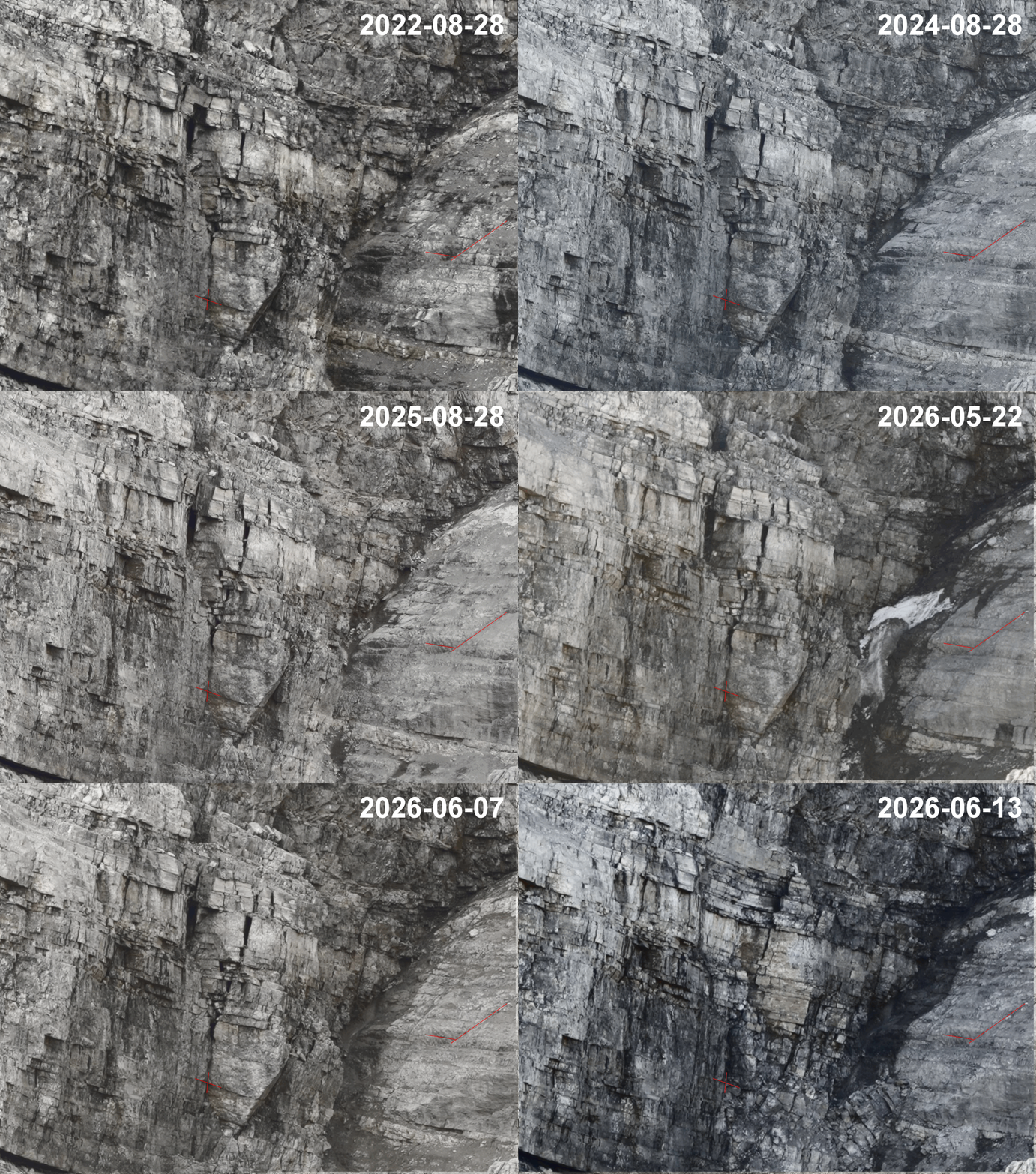
The Chair of Landslide Research has monitored the Hochvogel with several methods for more than a decade (Leinauer et al., 2020). Both sides gain from the joint work. AlpGeotech tests its products in conditions that no laboratory can reproduce, and the university gets additional data for its research. The methods also check each other. Laser scanning campaigns carried out jointly and the deformation camera on the southwest wall confirm that a seismic trigger was a real rockfall and give its volume. The seismic record in turn supplies the timing and type of failure, which neither method can deliver.

Continuous operation on this summit has also been a test of the hardware. Early outages were caused by the power supply and by surge protection. They were fixed with improved grounding and a revised power budget. The repeated lightning strikes during the summers of 2025 and 2026 drove further improvements to the protection concept, and these now apply to all exposed AlpGeotech installations.

The following section shows the site overview, the layout of the monitoring stations and selected records from the seismic and deformation sensors.

Monitoring Hochvogel

References

Barbosa, N., Leinauer, J., Jubanski, J., Dietze, M., Münzer, U., Siegert, F. & Krautblatter, M. (2024): Massive sediment pulses triggered by a multi-stage 130 000 m3 alpine cliff fall (Hochvogel, DE-AT). Earth Surface Dynamics 12(1), 249-269. DOI: 10.5194/esurf-12-249-2024

Barth, H. von (1874): Aus den nördlichen Kalkalpen. Munich.

Deutscher Alpenverein (2017): Bäumenheimer Weg. DAV Donauwörth.

Leinauer, J., Jacobs, B. & Krautblatter, M. (2020): Anticipating an imminent large rock slope failure at the Hochvogel (Allgäu Alps). Geomechanics and Tunnelling 13(6), 597-603. DOI: 10.1002/geot.202000027

Leinauer, J., Dietze, M., Knapp, S., Scandroglio, R., Jokel, M. & Krautblatter, M. (2024): How water, temperature, and seismicity control the preconditioning of massive rock slope failure (Hochvogel). Earth Surface Dynamics 12(5), 1027-1048. DOI: 10.5194/esurf-12-1027-2024

Wassmann, L. (2025): Development of a geophone-based real-time monitoring system for rockfalls in alpine terrain (Hochvogel). Master's thesis, Chair of Landslide Research, Technical University of Munich.

Technology Solutions: Geology, Quality, and Service

AlpGeotech